Warming weather this week creates a great chance to WAG
From Pat Childs, Wagmaster, photo by Mel Hunt
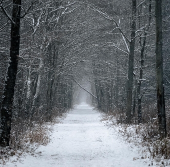
Snow is great for skiing but center is being run by snowmobiles. I made my own tacks off to the side and enjoyed a ski going south from Yorks corners Saturday afternoon.
I did some on the snowmobile path and it was ok too. The trail may be spun down to the grass if a lot of them ran it this weekend. I only encountered 4 and they slowed down and were no problem.
Walkers would find it easy to walk on the packed down snow left by the snowmobiles. Happy winter!

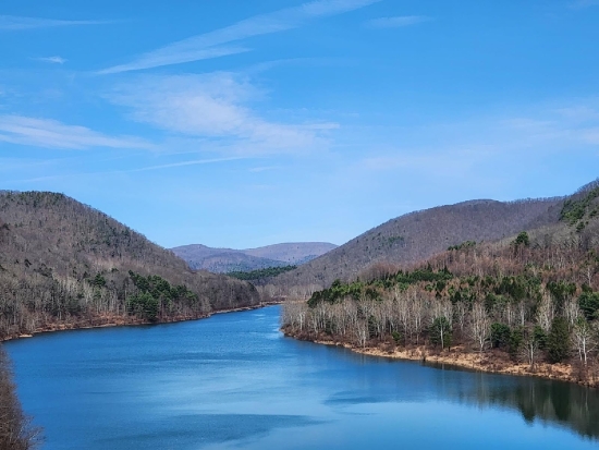
More on the Wellsville, Addison, Galeton Railroad Trail, the WAG:
If you haven’t visited this unique NY State public land between Wellsville and the Pennsylvania State borderline, put it on your list for 2026. Go to NYS WAG Trail site
This is the most popular walking trail in the wilds of Allegany County for several good reasons, here are my top three:
1- The WAG Trail is on the banks of the legendary Genesee River, one of the few rivers in North America that flows north. A nature lovers dream and depending on the time of year, it is hard to not find at least a marvel like a bald eagle, osprey, whitetail deer, river otters, ducks, geese, songbirds, cottontail rabbits, red fox, the list goes on and on.
2- Flat terrain invites all ages, abilities, and modes. Walkers, joggers, runners, mountain bikes, baby strollers, two legs, four legs, just NO ATV’s. Snowmobiles are allowed and some sections are groomed by the local snowmobile club. No other motorized vehicles are allowed on the trail.
3- Multiple points of access is another great part of the WAG trail. Many start in Wellsville at the famous trestle bridge at Island Park, walk through the ruins of the Sinclair Oil Refinery, and south toward “Gypsy Lane.” From that Wiedrich Road bridge south, the trail has many other places you can hop on and move either north or south. Most stops like Jack Bridge Road or Mapes Road have dedicated parking areas. Below are some of the access points south of Wellsville with map links:
- Carter Road parking area (42.075717°N, 77.927248°W) Google Maps
- Mapes Road parking area (42.046297°N, 77.926540°W) Google Maps
- Graves Road parking area (42.024614°N, 77.907379°W) Google Maps
- Hawks Road north parking area (42.016593°N, 77.893977°W) Google Maps
- Hawks Road south parking area (42.001079°N, 77.878507°W) Google Maps